Project Detail
Murang’a Project
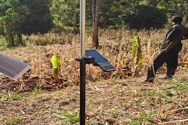
Meridian Mapping was contacted by Wanjohi & Wawuda Advocates to survey a parcel of land in Murang’a Kiharu after the client, Mr. Mbui, contested the boundary that had been resurveyed by the land registrar, Murang’a SOK. The objectives included identifying the correctness of existing boundaries as per original PIDs and RIMs, establishing how the new boundary had altered the acreages of the contested parcels and whether it was actually correct. We were able to conduct the survey and detailed out a report that was used by Wanjohi & Wawuda Advocates to table a court case at the Murang’a land law court.
Related Projects
Gigiri Project
We conducted a resurvey of parcels 91/354 and 91/356 in Nairobi. The process involved conducting searches, determining the amount owed for land rent and rates for the two parcels and paying the requir...
Read More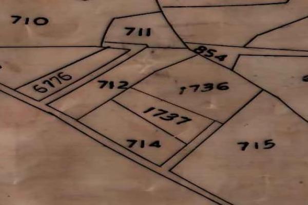
Embu Project
Unlike detailed cadastral surveys, general boundary surveys focus on identifying the general extent of land parcels rather than precise measurements. They play a vital role in maintaining up-to-date l...
Read More
Rosslyn Sectional Survey
The term "Rosslyn Sectional Survey" refers to the cadastral and sectional property survey conducted in the Rosslyn area of Nairobi, Kenya. Sectional surveys are essential for subdividing a single land...
Read More